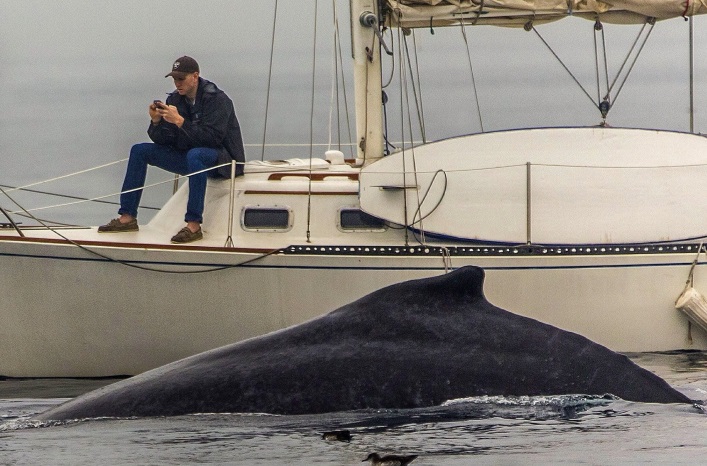
I overheard a neighbor of mine describe the way in which his vessel ran directly into a piling of the old Berkeley Pier, in the heart of San Francisco Bay. His story was full of arm waving and accusations. What grabbed my attention the most was his nonchalant admittance to using GMaps to navigate the Bay. In this story, the vessel operator left a boat yard in Richmond, set an magnetic autopilot track for Emeryville, and stayed mostly below decks “out of the cold.” I stole a peek at the damage, and noticed that the bow sprit had been ripped out of the fiberglass hull and bent 190 degrees backwards, and gash ran from the deck to the waterline on the prow.
Many years ago I worked as the dockmaster at an East Bay Marina. It was common place for tenants and guests to ask for boating advice, specifically when arriving and departing the marina (which is the correct way to ascertain local knowledge). It was all to common for the questioners to pull out their smart phones and ask me to describe the best route on GMaps. Sometimes these guest would describe how they had been stuck in the mudflats just outside of the marina, exclaiming that we should mark the channel better (the channel is well marked and our PATON is approved and registered with the Coast Guard).
Most recently, I was hired to captain a power vessel out of Sausalito for Fleet Week. This beautiful Ocean Alexander had all the bells and whistles and drove like a dream. However, it was a 15 year old vessel with 15 year old electronics. While doing pre-underway checks I quickly noted that the Raymarine C120 placed our vessel-icon on the dock. It took me a bit to then realize the chart-display showed the marina as it looked 20 years ago (much different than its layout today). This lead me to the conclusion that this device would have little use and would have to be supplemented with additional navigation equipment – no big deal…. Then came time to bring the vessel in at night, into a marina I rarely run in and out of, with a supercargo who’d been enjoying himself all day. As we approached the entrance to the marina, I asked the owner and guests to take down the volume a few notches and dim the lights. The owner ran upstairs and decided they’d tell me how to make the final approach – they then proceeded to zoom in on the Raymarine Chartplotter and describe how he normally navigates the close quarters docking situation – and he directed me through an area which I knew to be incorrect. I said as much, and out came his Iphone followed by GMaps. It took a bit of negotiation to get this supercargo out of the wheelhouse so I could focus. I was able to utilize the notes I took as I left the marina, my personal electronic chart, and the few aids to navigation which were present, to get the boat safely and efficiently to the dock.
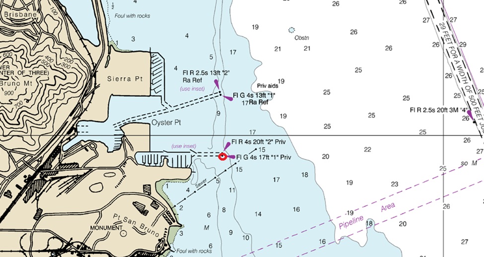
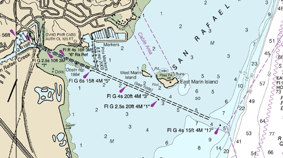
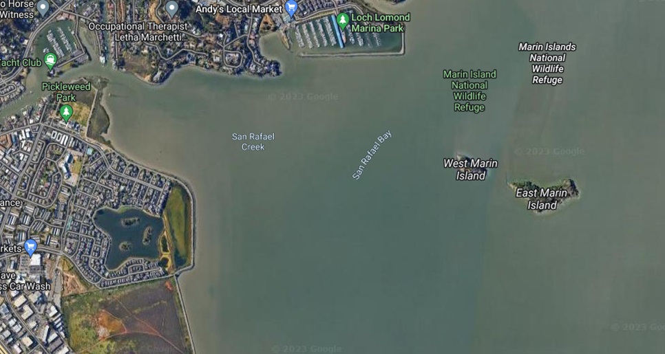
My personal stories above need not impress you. The dangers of using GMaps to navigate a vessel should be self evident, but if not, please read on. Take the lack of information for example: there are no soundings, aids to navigation(ATON), traffic lanes. Satellite view is worse: while ATON may be visible, its characteristics are not, mud flats (like the approach to San Rafael Creek) appears as navigable water, the navigable spans of bridges become obscured (zoom in on San Mateo Bridge), ad infinitum.
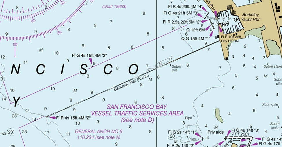
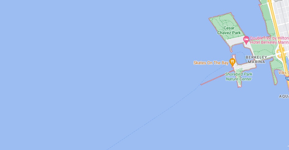
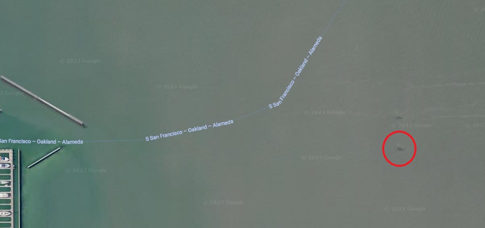
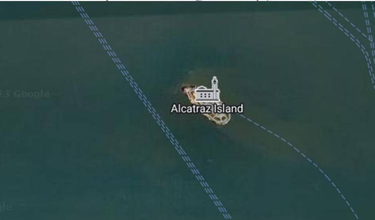
GMaps also plots ferry traffic lanes through non-navigable areas! If you follow most ferry lines you’ll quickly notice it runs through shallow water and obstructed areas. Below are the google ferry lines at Oyster Point and running through the Berkeley Pier. I’ll close this article at the bottom of this post with a side bar on the Berkeley Pier.
My objective is not to say that GMaps is useless, nor am I saying it is necessarily dangerous to safe navigation. GMaps may actually have a place in navigation. Afterall, a Prudent Mariner uses as much information as they can get, and GMaps is technology that offers much information. I’m also not advocating for the use of chart plotters or paper charts alone. All navigation aids in the forms of charts, digital screens, or physical ATON need to be supplemented with other material to form a comprehensive view of the area to be navigated – this is a step towards being prudent. This supplemental material includes, but is not limited to, tide tables, weather reports, Local Notice to Mariners, Marine Broadcasts, local knowledge, coast pilots, light list, and real time audio/visual information. But don’t even read into that statement too far. I’m also not advocating for a anal mindset about boating, because I do believe boating can be and should be fun. You need not dive into hundreds of reference manuals and reports each time you leave the dock. You only need to have a high enough degree of certainty of the navigability of the areas in which you MAY boat before leaving the dock. So I acknowledge experience as an asset, but I also preach staying mindful of complacency.
On the Berkeley Pier:
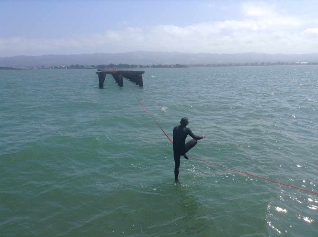
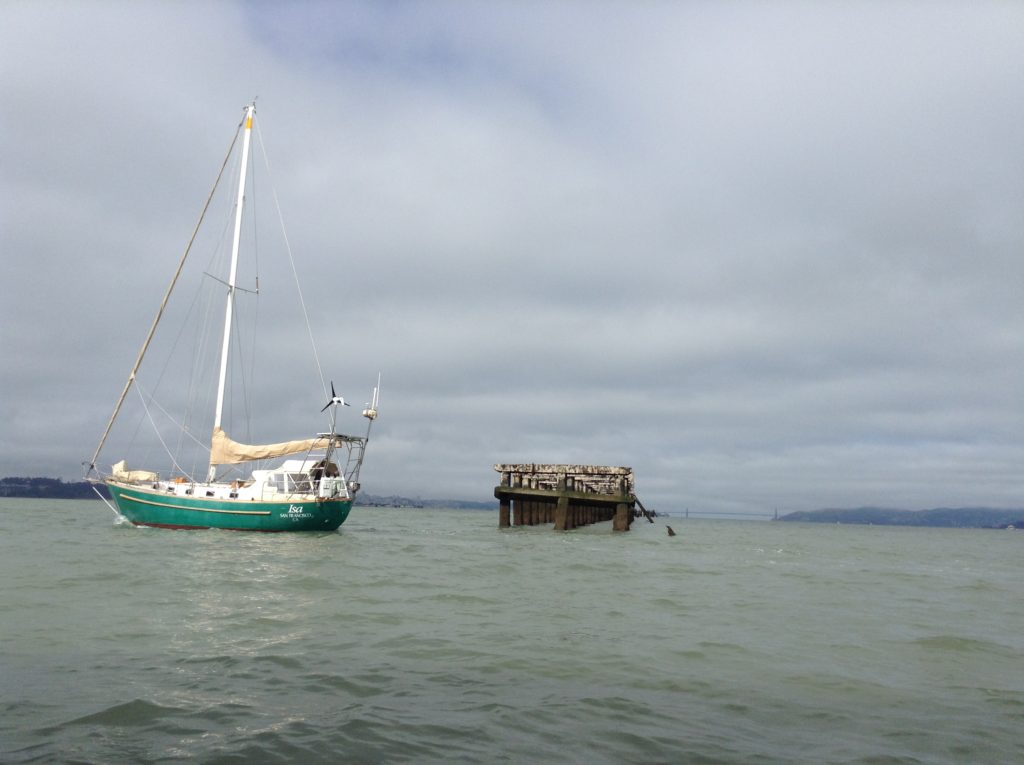
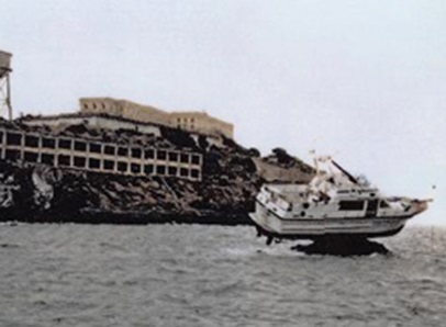
Berkeley Pier is a navigation hazard and to thoughtlessly pass through it on any vessel is putting your vessel and passengers at risk. The pilings which can be seen at high tide, the pilings which cannot be seen at low tide, the lack of survey for over 50 years, and the web of debris, recreational use, blind spots, shoaling, and the high speed vessel traffic that runs adjacent to the pier, all add up to major risks. On the Berkeley Pier “gap.” I am constantly troubled as I see small passenger ferries use the Berkeley Pier Gap. Yes, Google Maps marks it on its interface as a ferry lane – but “why” it does this is beyond me. Yes, many ferries, like Tideline, and now the Genetech Commuter Ferries, use this gap to cut off precious minutes to their commutes. Yes, recreational boaters have used this gap for decades. Yes, I myself often take power boats, sailing vessels, and even an inflatable donuts (true story) through the gap at various times. Though the gap is not within a “navigable channel,” it does not get surveyed regularly like the Berkely Channel does, it’s bottom is roughly 5 feet at a zero tide, it’s unlit, it funnels vessel traffic through a major blind spot, and it comes with all the navigation hazards mentioned above. There is at least one piling which tops out at the -1 foot tide mark (picture below) on the north western corner. I would love a community of local sailors to pipe up on this article to discuss the merits, or lack thereof, of using the Berkeley Gap.
Is it safe? Is it reasonable for Commercial Traffic to use it? What are the best practices for those who decide to use it? To jump the gun on this discourse, I do admit to using this gap with recreational boats. My personal practices include acknowledging all the risks I mentioned above, and planning accordingly.